Fotosearch Royalty Free Stock Photography
Digital images licensed by Publitek, Inc.
Fotosearch and Photosearch are trademarks of Fotosearch, LLC
All rights reserved © 2026-01-21
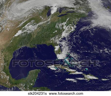
Satellite view of the storm system that generated the F-4 tornado in Moore, Oklahoma. Stock Photograph

Satellite view of the storm system that generated the F-4 tornado in Moore, Oklahoma.
stk204231s | StockTrek | Royalty Free
Add to Lightbox
Share Image
Keywords
circulating, climate, cloud, cloudy, coast, coastline, color image, danger, destruction, disaster, extreme weather, f4 tornado, full frame, green, horizontal, hurricane, land, landmass, meteorology, motion, natural disasters, nature, no people, ocean, oklahoma, outdoors, overhead view, photography, physical geography, power in nature, powerful, satellite view, space, storm, thunderstorm, topography, tornado, united states, view from space, weather, stock image, images, royalty free photo, stock photos, stock photograph, stock photographs, picture, pictures, graphic, graphics, fine art prints, print, poster, posters, mural, wall murals, stk204231s
circulating, climate, cloud, cloudy, coast, coastline, color image, danger, destruction, disaster, extreme weather, f4 tornado, full frame, green, horizontal, hurricane, land, landmass, meteorology, motion, natural disasters, nature, no people, ocean, oklahoma, outdoors, overhead view, photography, physical geography, power in nature, powerful, satellite view, space, storm, thunderstorm, topography, tornado, united states, view from space, weather, stock image, images, royalty free photo, stock photos, stock photograph, stock photographs, picture, pictures, graphic, graphics, fine art prints, print, poster, posters, mural, wall murals, stk204231s
Show Keywords
- Low Resolution (1 MB)9.1" x 7.5" @ 72dpi JPG68
- Medium Resolution (10 MB)6.9" x 5.7" @ 300dpi JPG140
- High Resolution (28 MB)11.5" x 9.5" @ 300dpi JPG215
- Ultra High Resolution (51.2 MB)15.6" x 12.8" @ 300dpi JPG250
View larger image sizes
View StockTrek license agreement

