Fotosearch Royalty Free Stock Photography
Digital images licensed by Publitek, Inc.
Fotosearch and Photosearch are trademarks of Fotosearch, LLC
All rights reserved © 2026-01-22
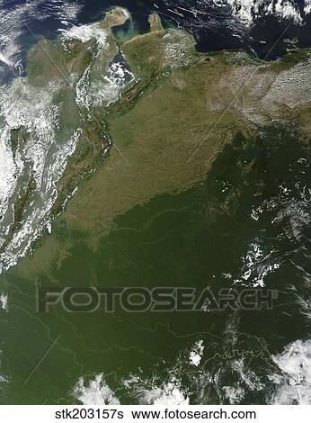
Satellite view of eastern Columbia and northern Venezuela. Stock Photograph

Satellite view of eastern Columbia and northern Venezuela.
stk203157s | StockTrek | Royalty Free
Add to Lightbox
Share Image
Keywords
amazon, andes, atabapo river, brazil, colombia, color image, country, grasslands, green, guaviare, japura river, land, landmass, landscape, llanos, meta river, mountain, mountain range, no people, orinoco, outdoors, photography, physical geography, plains, river, satellite view, south america, space, venezuela, vertical, waterways, stock image, images, royalty free photo, stock photos, stock photograph, stock photographs, picture, pictures, graphic, graphics, fine art prints, print, poster, posters, mural, wall murals, stk203157s
amazon, andes, atabapo river, brazil, colombia, color image, country, grasslands, green, guaviare, japura river, land, landmass, landscape, llanos, meta river, mountain, mountain range, no people, orinoco, outdoors, photography, physical geography, plains, river, satellite view, south america, space, venezuela, vertical, waterways, stock image, images, royalty free photo, stock photos, stock photograph, stock photographs, picture, pictures, graphic, graphics, fine art prints, print, poster, posters, mural, wall murals, stk203157s
Show Keywords
- Low Resolution (1 MB)7.2" x 9.4" @ 72dpi JPG68
- Medium Resolution (10 MB)5.5" x 7.1" @ 300dpi JPG140
- High Resolution (28 MB)9.1" x 11.9" @ 300dpi JPG215
- Ultra High Resolution (51.5 MB)12.4" x 16.1" @ 300dpi JPG250
View larger image sizes
View StockTrek license agreement

