Fotosearch Royalty Free Stock Photography
Digital images licensed by Publitek, Inc.
Fotosearch and Photosearch are trademarks of Fotosearch, LLC
All rights reserved © 2026-01-26
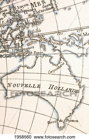
Australia Circa 1760. From Atlas De Toutes Les Parties Connues Du Globe Terrestre By Cartographer Rigobert Bonne Published Geneva Circa 1760. Stock Image

Australia Circa 1760. From Atlas De Toutes Les Parties Connues Du Globe Terrestre By Cartographer Rigobert Bonne Published Geneva Circa 1760.
1958560 | Design Pics RM | Rights Managed
Add to Lightbox
Share Image
Keywords
18th, australia, bonne, cartography, century, circa, design pics, diemen's, diemens, eighteenth, guinea, historical, history, holland, joined, land, making, map, new, rigobert, tasmania, van, stock image, images, royalty free photo, stock photos, stock photograph, stock photographs, picture, pictures, graphic, graphics, fine art prints, print, poster, posters, mural, wall murals, 1958560
18th, australia, bonne, cartography, century, circa, design pics, diemen's, diemens, eighteenth, guinea, historical, history, holland, joined, land, making, map, new, rigobert, tasmania, van, stock image, images, royalty free photo, stock photos, stock photograph, stock photographs, picture, pictures, graphic, graphics, fine art prints, print, poster, posters, mural, wall murals, 1958560
Show Keywords


